Flatbush Ave is well served by public transportation. Brooklyn features extensive public transit.
Atlantic Terminal formerly called Flatbush Avenue, connects all lines towards Flatbush Ave including LIRR (Long Island Rail Road). The stretch of stations from Prospect Park to Avenue H is in Flatbush on Norstrand Ave and ends by Brooklyn College on Flatbush Ave. Service to Manhattan can take as little as 15min to 1/2 an hour. TRAIN All trains passing via “Downtown Brooklyn” – Whatever directions you navigate can easily be met with one transfer (which is free :-). South Brooklyn/Flatbush Ave is more dependent on Buses (or Limo if you wish). Check maps before you leave your home destination and follow on site instructions if there is any change (such occur on weekends or in time of reconstructions/maintenance). If you have an Ipod you can download digital maps and follow your path. One of them with current updates & directions that you can save on your gadget is here (NYC Mate). “The Brighton Line”, with its  and
and  trains, has a number of stops within the community.
  There is also “S Line” or
  train. All stations of the “Nostrand Avenue Line” (
  and
and  trains) south of President Street are also within Flatbush.
  “Lexington Line” also cover Flatbush Avenue with trains
  and
and  .
.  active MTA Subway map BUS
 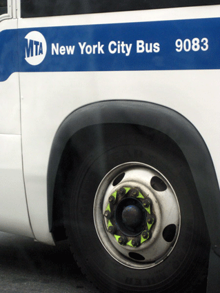 “Flatbush Ave Line” in both directions is the
  bus. Several other bus routes run through Flatbush:
  ,
,  ,
,  , via Church Ave
  , via Norstrand/New York Ave
  and via Bedford/Rogers Ave
  are major routes that serve the neighborhood. The
  connects Flatbush with “Rockaway Park”, while the
  provides a relatively rapid connection to “Downtown Brooklyn”. NOTICE: If you have iPhone OR Android smart phone there is an amazing app waiting for you. You do not have to have “wifi connection” to browse your maps. Yeap! – enjoy comfort of have them on your phone to travel NYC. Thanks to “DENSEBRAIN” products. Download them here (NYC Mate). OR Plan yout trip/visit on your computer by: MTA (Trip PLanner+ by; Subway, Bus, Express Bus or Rail) Google Maps
and trains, has a number of stops within the community. There is also “S Line” or train. All stations of the “Nostrand Avenue Line” ( and trains) south of President Street are also within Flatbush. “Lexington Line” also cover Flatbush Avenue with trains and . active MTA Subway map BUS “Flatbush Ave Line” in both directions is the bus. Several other bus routes run through Flatbush: , , , via Church Ave , via Norstrand/New York Ave and via Bedford/Rogers Ave are major routes that serve the neighborhood. The connects Flatbush with “Rockaway Park”, while the provides a relatively rapid connection to “Downtown Brooklyn”. NOTICE: If you have iPhone OR Android smart phone there is an amazing app waiting for you. You do not have to have “wifi connection” to browse your maps. Yeap! – enjoy comfort of have them on your phone to travel NYC. Thanks to “DENSEBRAIN” products. Download them here (NYC Mate). OR Plan yout trip/visit on your computer by: MTA (Trip PLanner+ by; Subway, Bus, Express Bus or Rail) Google Maps